Fires on land concessions for palm cultivation in Indonesia
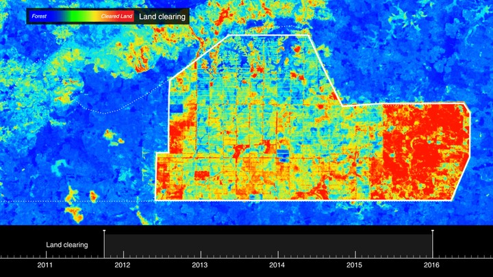 Derived analyses of burn scars detected in Landsat image time series over a palm oil concession in West Papua, Indonesia. The image visualizes Normalised Burn Ratio (NBR) and was modified by Forensic Architecture
I supported a Forensic Architecture investigation commissioned by Greenpeace International into the intentionality of peatland fires over land concessions for palm oil cultivation in Indonesia. Find out more about the investigation here