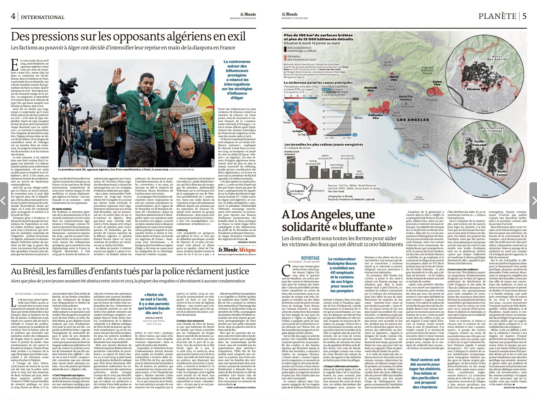
Mapping building damage during the 2025 Los Angeles wildfires
 Our data on fire damage to buildings on the front page of the January 14th, 2025 New York Times.
Growing up in California – hazard country – motivated me to study hazards, disasters, wars, and conflict. When the Los Angeles widlfires hit, with friends and colleagues directly affected, I worked with Jamon Van Den Hoek to produce a preliminary assessment of damage using Sentinel-1 satellite radar data that we distributed freely to first responders in California and newsrooms around the world.
Our data on damage were included in reports on the severity of fire damage from several newsrooms (tabulated below) and were made openly-available through the official NASA Disasters data portal.